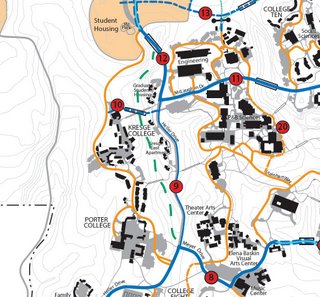
 Last Friday I attended the public meeting which reviewed the UCSC bike plan. This meeting was attended by local bike transportation advocates, student commuters, mountain bikers and representatives from transportation planning of the City of Santa Cruz.
A revised map of the bike plan was made available which included a dotted line that represented the Moore Creek trail (a.k.a "Star Wars"). This was a hopeful sign.
Some points as it relates to mountain biking
- This is one of the only bike plans in the UC system that addresses off-road trails.
- The recreational off-road trails portion of the plan generated a lot of very passionate written comments. Most of them were pro-mountain biking.
- There was no opposition to the off-road aspect of the bike plan at the meeting. I was expecting opposition but it never materialized.
- The Moore Creek trail may become the first legitimate trail in the preserve. The director of the Campus Natural Reserve, Maggie Fusari, commissioned a student to do her thesis on a re-route and I am currently in discussions on working on the logistics and funding for the project.
- Larry Pagler (transportation planning at UCSC ) suggested that the existing Chinquapin fire road could be converted to become a recreational trail. If so then we could probably use some of the road decommissioning and narrowing techniques that were employed at Annadale State Park to create a better recreational trail experience.
- This draft plan is pretty close to being finalized. This means that it is highly unlikely that recreational off-road trails will be pulled out of the document. This is the best news!
- It's clear that there aren't enough ways to get into UCSC from the City by bicycle. Bay and High Streets are both quite dangerous and intimidating to novice bike commuters. There was some discussion of propose bike access to Pogonip to open up an eastern transportation corridor into the upper campus from Harvey West Park.
- A suggestion was made to close McLaughlin Drive to private cars (service vehicles and buses would still be allowed) as a way to increase safety and circulation of pedestrians and bikes throughout the central core of the campus. This suggestion was very well received.
- They are still accepting feedback on the plan until December 18, 2006.
- There will probably be small revision to the plan which will be posted on the web
- The goal for completion and acceptance of the final bike plan is July 2007.
It looks like legal recreational trails is going to be a possibility at UCSC. Furthermore, we are starting the planning process to create a legitimate trail project up on UCSC. This trail project can be done independently of the acceptance of the bike plan.
Thank you very much for sending in your written comments to support recreational trails in the plan. They really helped. I hope we can count on the mountain biking community to help us build the trail network.

3 comments:
This is great news! I was one of those who wrote a letter in commenting about the off-road recreational trails proposed in the draft plan.
Awesome news. It's great to hear that there wasn't a lot of opposition to these plans. I think opening up the pogonip access road would a big step toward less traffic to and from the University as well.
Lovely blog thanks for taking the time to share this.
Post a Comment